
Storm Forecast
Valid: Sun 29 Jul 2012 10:00 to Mon 30 Jul 2012 06:00 UTC
Issued: Sun 29 Jul 2012 12:05
Forecaster: VAN DER VELDE
A level 1 and 2 were issued for Italy, Austria, Slovenia, Croatia, Hungary, Slovakia, eastern Poland, Batltic states mainly for severe wind gusts and large hail.Valid: Sun 29 Jul 2012 10:00 to Mon 30 Jul 2012 06:00 UTC
Issued: Sun 29 Jul 2012 12:05
Forecaster: VAN DER VELDE
A level 1 was issued for eastern Germany, northern Austria, Czech republic, western Slovakia, western and northern Poland mainly for isolated excessive convective rain.
A level 1 was issued for eastern Finland and NW Russia mainly for severe wind gusts, tornado chances and large hail.
A level 1 was issued for NE Spain mainly for large hail.
SYNOPSIS
A very large scale 500 hPa low centered over Scotland spans across most of Europe with a cyclonic flow pattern. Western Russia and eastern Belarus and Ukraine are under the influence of an anticyclone. At mean sea level, high pressure is only present deep into Russia and over the Atlantic near the Azores with a ridge toward France. Moderate unstable airmass stretches from northern Ital, Hungary, eastern Poland, Baltics all the way info northern Finland. A wave along the western side of the airmass moves from N Poland over the Baltic Sea northward.
DISCUSSION
...N Italy, Austria, Hungary, Slovakia, Poland...
09Z observations indicate 13-16 g/kg mixing ratios across Poland and Hungary. The area appears divided into a humid, cloudy western section with less than 500 J/kg but high precipitable water content and a dry eastern section where MLCAPE values will easily reach 1200-2500 J/kg over a large region. Both areas are under moderate 10-15 m/s 0-6 km shear which can organize multicells and supercells, the latter especially when helped by local orographic winds. These will produce large to very large hail. 00Z Poprad sounding shows around 11 g/kg mean 0-1000m mixing ratio under a very dry 25 degrees dewpoint spread in mid levels. This evaporative cooling potential is very favorable for microburst and general gust threat. N Italy will see fewer storms, as the trough passes early. It has a better timing for Hungary northward.
...N Poland and Baltic states...
The interface between the moist and dry regimes can see locally excessive convective rainfall, in particular near the occlusion tracking from N Poland northward near the coast of Lithuania and Latvia, mostly remaining over sea. This region is more interesting however because of the presence of large 0-1 km shear (15 m/s) and 0-6 km shear (20-25 m/s) which enhances potential for tornadogenesis and also favors bow echos producing severe wind gusts in the high LCL, high delta-theta-e airmass across the Baltics. Large hail is also likely. The cold front extending southeastward from the occlusion will have a more favorable angle with the flow to produce a severe wind producing squall line over NE Poland into Lithuania and Latvia.
...Finland and NW Russia..
While deep layer shear is just 10-15 m/s, 0-1 km shear and 0-3 km SREH are enhanced to 10 m/s and 200 m2/s2 respectively, which in combination with 400-800 J/kg MLCAPE creates favorable conditions for some storms with rotating updrafts producing hail and severe wind gusts. A tornado is not excluded as well. Background flow in lowest kilometers is around 30 kts.
... SE UK...
The low-level instability under the upper low over British Isles and Benelux may give rise to some spout-type tornadoes, if winds would weaken.
...NE Spain...
Large hail could occur in isolated supercell storms forming in a moderate shear environment (20 m/s) with high cloud base.
Opozorilo od ARSA je bilo izdano naknadno
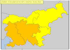
velja od 29.07.2012 13:00 CET Do 29.07.2012 23:00 CET
Nevihte Stopnja ogroženosti: Oranžna
en: Slovenia / North-East : en: Heavy thunderstorms are possible, accompanied by local intense precipitation, hail and gusty winds. sl: Slovenija / severovzhod : sl: Možne so močnejše krajevne nevihte z nalivi. točo in močnejšimi sunki vetra.


Napoved velikosti toče.


Lifted index je bil kar 10

Cape(Energija) je bil zelo visok na vzhodu države med 3000-3500J/kg)


Še pogled na spletno kamero. Vidni že prvi nevihtni oblaki v smeri Avstrijske Koroške.


Ob 15:45 sem se odločil da grem na čejs na Dravsko polje. Nevihtna linija je prihajala iz Avstrijske Koroške. Najboljšo pozicijo sem imel na območju Rač ,kjer sem imel razgled na dve celici,eno v smeri Radelj ob Dravi drugo pa na območju Šentilja oz Pesnice..Po vsej verjetnosti sta bili supercelici.Kakšnih zanimivih struktur pa žal ponovno ni bilo.Bilo je zelo vetrovno max sunek je bil 60km/h 16,7m/s,lokalno tudi več izmerjen pa na območju Rač,Kungote...
okolica Rač
Nevihtni oblak,slikano na Hajdini pri Ptuju.
Nekaj polomljenih vej v Hajdošah(blizu term)
Nevihta doma
Nevihta med 18:18:40 doma.Padlo je 8,6mm dežja, max inteziteta padavin je bila 126,6mm/hr.Med okoli 18:09-18:15 je tudi padala toča max premer 1cm. Pred nevihto ob 16:49 je zapihal močan SZ veter,ki je dosegel drugo najvišjo hitrost vetra od kar imam Davisko,in sicer 48,3km/h ,na odprtem tudi do 60km/h(ponekod na Dravskem polju tudi do 70km/h). Maksimalna temperatura je bila 31,0 stopinj C.Bilo je zelo soparno vreme ,saj vlaga ni padla pod 50%. Najnižja je bila ob 16:48 in sicer 51%, rosišče pa je bilo 22 stopinj C.
Močan veter max sunek 60km/h 16,7m/s
http://www.youtube.com/watch?v=CVPEdLsfF60&feature=plcp
http://www.youtube.com/watch?v=OC9yeakScIc&feature=youtu.be
Supercelica?
http://www.youtube.com/watch?v=0QyOjv2tB8M&feature=youtu.be




Ni komentarjev:
Objavite komentar