Storm Forecast
Valid: Mon 24 Sep 2012 06:00 to Tue 25 Sep 2012 06:00 UTC
Issued: Sun 23 Sep 2012 22:13
Forecaster: TUSCHY
A level 2 was issued for S/SE France and N-Italy
mainly for excessive rainfall, large to very large hail, severe wind
gusts and an isolated tornado event.
A level 1 was issued for parts of Benelux and Germany mainly for strong to severe wind gusts and an isolated tornado event.
A level 1 was issued for far SE Germany and parts of N-Austria mainly for large hail and strong to severe wind gusts.
A level 1 was issued for parts of the E-Adriatic Sea mainly for large hail, heavy rain, strong to severe wind gusts and an isolated tornado risk.
SYNOPSIS
The predominant vortex over N-Europe shifts eastward, stepping aside for another cyclonic vortex, which approaches from the N-Atlantic. A strengthening depression from the Bay of Biscay gets incorporated into the circulation of the second vortex and the net result will be a major cyclonic vortex, centered over UK, which becomes the steering mechanism for quite some time. Over the Mediterranean, geopotential heights start to decrease with weak ridging present over the far E-Mediterranean.
Side-note:
Multiple structural changes occurred and will occur with the consolidating depression, which moves off the Bay of Biscay to the north/northeast. After initiated by a southbound moving upper low with a distinct tropopause fold during the overnight hours of the 21st to the 22nd, roughly 36h of a slightly less barocline atmosphere allowed for some low-end core modification, although negligible (and still classified as a true cold core low). As of writing (23rd), a plume of slightly modified tropical air (modified due to onshore trajectories into the depression's center), encircled most of the center and assisted in disorganized but slightly deeper convection with no distinct banding present. However this pushed the depression near the shallow warm core structure on available phase diagrams. During the afternoon hours of the 23rd however, an approaching frontal boundary from the NW marked the beginning of another round of enhanced baroclinity with models showing the evolution of a distinct tropopause fold over Ireland and UK during the forecast period, bending into the system. This increase of baroclinity results in a rapid deepening phase, which starts around the beginning of my forecast period and offers a central pressure drop of at least 10 K in probably less than 24 h while crossing UK from the SW with a strong turn to the NW during the night.
This results in a quite complex frontal and thermal structure of that low, as the majority of the models now propose some type of thermodynamic core modification. Current thinking is that a moderate warm-core seclusion takes place during the forecast although described history of that depression may offer a better defined LL warm core structure compared to truley extratropical cases. Latest ASCAT scans reveal a quite symmetric near surface wind field with uncontaminated 30-40 kt winds along the W/S and SE-ern fringes (much less defined along the NE quadrant) and this well defined wind field in the lower troposphere remains intact during much of the forecast period.
To complicate that scenario once more, ongoing baroclinic transformation will result in more typical vertical wind field distribution of the extra tropics along the southern fringe, as a strong mid/high-level jet moves in from the west and crosses N-France and Benelux during the night. Along the northern fringe of the depression however (e.g. N-UK and Scotland), no modification is expected until 06Z due to the dominant and still westward pointing wrap-around occlusion, which keeps the shallow warm core intact.
DISCUSSION
... Far E-France, parts of Germany and parts of Benelux ...
At 06Z, a strongly tilted warm front will be situated over the Netherlands and N-Germany with a slow down of its northward shift forecast (in response to the rapidly deepening low over the UK). A surface cold front is about to exit E-France with a rapid NE-ward motion, so a constantly narrowing warm sector over Germany will be the result with some type of triple point evolving over NW Germany during the night, as the occlusion process builds east.
At mid/upper levels, a NE ward swinging trough affects the area of interest. This trough weakens significantly during its shift to the NE with strong mid-level NVA forecast atop the NE-ward surging cold front. Strong frontal circulation of the cold front however may offset some of those more negative effects in addition to other models, showing the upper trough slightly stonger with better cyclonic curvature. CI should occur, given weakly capped warm sector and healthy looking cold front. Scattered DMC activity is forecast.
From the thermodynamic perspective, the (sub)tropical background of that air mass features weak mid-level lapse rates for all areas beside those along and just north of the Alps (where Alpine EML fans out to the NE, affecting SE Germany and parts of Austria during the forecast). Forecast soundings confirm MIMIC-TPW output with 30 to roughly 40 mm TPW present behind the warm front, as deep plume of moisture spreads NE-wards. Of concern is the cloudy warm sector, which keeps diabatic heating limited, although not much extra heating is needed for some CAPE build-up, given surface and 925 hPa dewpoints in the mid tens (with a few stations upstream (NE France) even reporting surface dewpoints in the upper tens). Models like WRF show some break up of the thick cloud shield, so even some diabatic heating is forecast and therefore, we agree in the quite robust CAPE forecast of 500 to locally 800 J/kg MLCAPE (EZ on the lower-end side). CAPE might be the most robust over far NW Germany and Benelux with a second maximum over far SW/SE Germany and N-Austria. In-between (e.g. W-C Germany), somewhat worse moisture/stronger BL mixing result in substantially lower CAPE. Finally, LL CAPE might be enhanced as seen in some forecast soundings.
Kinematics are good, especially at lower levels. With the eastward punching mid-high level jet from N-France probably arriving too late, DLS remains modest with 15 to locally 20 m/s, nevertheless enough for organized convection. Similar shear magnitude however is also forecast in the lower troposphere (3km and 1km bulk shear). Not only the speed shear, but also SRH is enhanced with peaks in excess of 200 m^2/s^2 in the lowest km (e.g. ahead/along of the cold front).
Numerous rounds of CI are forecast:
a) Sporadic warm front activity over NW-Germany (ongoing from the overnight hours). Forecast soundings show some MUCAPE with veered profiles, but nothing severe is forecast. This was the main reason for expanding the low prob. lightning area far to the NE over NE Germany. The risk wanes until noon.
b) Warm sector convection. Coverage of convection is uncertain and depends on isolated better diabatic heating and forcing. Current thinking is that the Netherlands/NW Germany may see isolated activity during the morning hours onwards. However it will take some time before thunderstorms become surface based (probably until noon), so again no severe risk is forecast with that activity (at least until noon).
c) The main risk seems to evolve along the cold front and potential prefrontal convergence zone, which crosses the highlighted area during the daytime hours from SW to NE. Generally, the Netherlands/NW Germany (arrivial during peak heating) and SW Germany (better BL moisture) may see the highest probabilities for thunderstorms with less activity in-between. With worsening background forcing, a broken line of showers and thunderstorms is forecast, probably more solid over NW-Germany. Severe wind gusts will be the primary risk (with 25 m/s in 850 hPa) , but would not be surprised to see an isolated tornado report. The overall tornado risk might be steered by mesoscale processes/boundaries and locally better heating and therefore the overall risk is hard to pinpoint that far out. Over W-C Germany the severe risk might be low due to weak CAPE, but model forecasts diverge too much to split the level 1 into two distinct areas. Also, not much downward transport needed to mix 20-25 m/s winds down to the surface in showers/thunderstorms. The severe risk rapidly diminishes after sunset.
... SE Germany and N-Austria ...
The set-up seems quite favorable for an organized prefrontal wind shift zone, which races eastwards during the late afternoon and evening hours, affecting SE Germany and N-Austria. Given steeper lapse rates aloft and improving BL moisture result in roughly 800 J/kg MLCAPE. The consolidating convergence zone over S-Germany may spark isolated thunderstorms, also moving off the N-Alps to the NE. Northward expanding cirrus shield of an Italian cluster may keep instability limited over the area, which was excluded from the level 1. A few well organized multicells/isolated supercells with strong to severe wind gusts, large hail and heavy rain evolve further east over far SE Germany. Betimes, storms line up while entering N-Austria and the W-Czech Republic with a temporarily enhanced more concentrated severe wind gust risk over N Austria. Rapidly diminishing CAPE should lower the severe risk over the Czech Republic. The highest severe risk probably exists south and east of Munich (Germany) and west of Linz (Austria).
... SE France, parts of Switzerland, N-Italy and far S-Austria ...
An active severe weather day is in store for the area of interest. Falling pressure south of the Alps slows the eastward moving cold front down, while entering NW-Italy. This front may stall for some time, before moving leisurely to the east during the rest of the forecast. A vorticity lobe at mid-levels crosses the area from west to east and moves in an unstable and strongly sheared air mass south of the Alps. 500-1000 J/kg MLCAPE, 20-25 m/s DLS and 15 m/s 0-3 km shear create a favorable set-up for well organized multicells/supercells.
Current thinking is that an ongoing cluster of showers/thunderstorms approaches from S France (probably featuring a V-shaped MCS), which enters NW Italy until noon. The main risk with that activity will be excessive rain due to slow moving storms and abundant influx of moist Mediterranean air from the south. The tail-end of the MCS (e.g. along the coast of S/SE France) may be accompanied by isolated supercells with large hail and an isolated tornado risk, which was the reason for upgrading that part.
Thereafter, storms rapidly spread or evolve east over N Italy with well organized multicells/isolated supercells forecast. All kind of severe is forecast with strongest storms, including large to very large hail, strong to severe wind gusts, excessive rainfall amounts and an isolated tornado risk. The rainfall risk may be maximized over far NE Italy/far W-Slovenia.
Thunderstorms continue well into the night while spreading SE-wards along the E-coast of the Adriatic Sea. We also added a broad low prob. lightning area over parts of the N-Balkan States, as plume of better MUCAPE advects east.
... N-UK and Scotland ...
Westward wrapping occlusion shifts only slowly to the north during the forecast period. Prolonged period of lift/forcing/influx of very moist air and slow storm motion indicate a high probability for heavy rain. Some MUCAPE is forecast, so we do not want to exclude a sporadic thunderstorm event (not reflected on our outlook map).
Beside the rain risk, a gradually intensifying easterly LLJ with 850 hPa winds up to 30 m/s results in severe wind gusts over Scotland (especially at more exposed areas). This risk is not included due to non-existent DMC activity.
During the overnight hours, thunderstorm probabilities increase over the English Channel,the S-North Sea and the N-Bay of Biscay as cold air at mid-levels spreads to the south and east.
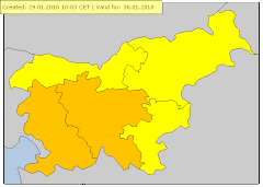
Opozorilo (meteoalarm)
velja od 24.09.2012 01:00 CET Do 24.09.2012
23:59 CET
Veter Stopnja ogroženosti: Rumena
en: Slovenia / North-East : en: maximum wind speed : from 50
to 70 km/h. en: sl: Slovenija / severovzhod : sl: maksimalna hitrost vetra : od
50 do 70 km/h. sl:
velja od 24.09.2012 16:00 CET Do 24.09.2012
23:00 CET
Nevihte Stopnja ogroženosti: Rumena
en: Slovenia / North-East : en: Thunderstorms are possible,
accompanied by local intense precipitation and gusty winds. sl: Slovenija /
severovzhod : sl: Možne so krajevne nevihte z lokalnimi nalivi in močnejšimi
sunki vetra.
Opis situacije
Moja prva CG-jevka




Ni komentarjev:
Objavite komentar