Storm Forecast
Valid: Mon 01 Oct 2012 06:00 to Tue 02 Oct 2012 06:00 UTC
Issued: Sun 30 Sep 2012 22:07
Forecaster: TUSCHY
Valid: Mon 01 Oct 2012 06:00 to Tue 02 Oct 2012 06:00 UTC
Issued: Sun 30 Sep 2012 22:07
Forecaster: TUSCHY
A level 1 was issued for the C-Mediterranean mainly
due to large hail (an isolated very large hail event is possible over
Sicily/S-Italy), heavy rain, strong to isolated severe wind gusts and a
low-end tornado risk.
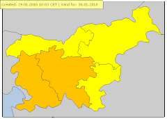
A level 1 was issued for Slovenia, Croatia and Hungary mainly due to isolated large hail, heavy rain and strong wind gusts.
SYNOPSIS
A constantly weakening upper level trough over Italy continues to move to the E/NE with further weakening anticipated. Scattered to widespread convection occurs in the area of influence of that trough and thunderstorm activity may spread far to the NE. A weak cold-core low affects the far E-Mediterranean/W-Turkey but the highest probabilities for isolated deep convection evolves to the east of our forecast area. Weak ridging affects parts of NE Europe, before another trough approaches NW Europe from the Atlantic.
DISCUSSION
... C-Mediterranean, parts of the Balkan States all the way to W-Ukraine ...
Constantly de-amplifying upper trough slowly moves to the ENE and finally atop the Adriatic Sea during the overnight hours. This feature will be the main reason for scattered to widespread CI within the highlighted areas. Despite the favorable conditions for CI, it remains uncertain, where any hot spot of thunderstorm activity might be as mid level trough looses organization and surface boundary outruns best forcing and slowly dissolves over S-Italy and the Ionian Sea.
Brisk SW-erly flow with moderate shear values of 15-20 m/s overlap with moderate to strong CAPE signals on the order of 1-1.5 kJ/kg MLCAPE (peaks mainly offshore and along the coastal areas with lower values onshore). Therefore, conditions remain supportive for organized multicell thunderstorms and isolated supercells. Large hail, strong to isolated severe wind gusts and heavy rain will be the main risk next to a low-end tornado risk with any mature supercell. However, there is the chance of a more robust severe risk for the following areas:
a) Sicily and S-Italy see rich BL moisture with surface dewpoints in the lower to mid twenties and steep mid-level lapse rates atop, which will yield MLCAPE in excess of 2000 J/kg. Despite some forcing affecting the area of interest during the day, models hesistate to show any more robust CI as strong cap weakens only on a slow rate from NW to SE. Any storm, which manages to evolve will be able to produce large hail (an isolated very large hail possible), strong to severe wind gusts and heavy rain. A sporadic tornado event depends on mesoscale features like outflow boundaries or locally enhanced shear by the orography.
b) C-Italy and E/NE coast of the Adriatic Sea. Placed beneath an unidirectional sheared environment with a favorable connection to rich moisture may result in a few training thunderstorm events. Despite weak flow in the lowest 2 km for most places, local models indicate the chance of a few convergence zones, which might be the foci for training or slow moving CI. Heavy rain will be the main hazard with that activity.
Uncertainties remain too high to upgrade any part of the broad level 1 area.
During the afternoon hours onwards, a plume of deep tropospheric moisture advects NE-wards along the W fringe of a NE-ward fanning EML. With large scale forcing approaching from the SW, thunderstorms may spread far to the NE. During the afternoon and evening hours, surface based convection will be possible especially over Croatia and Hungary. Isolated large hail, heavy rain and strong wind gusts will be the hazard. Betimes, storms become more elevated and sub-severe, while affecting parts of the W-Ukraine and S-Belarus during the night.
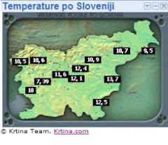
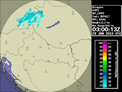
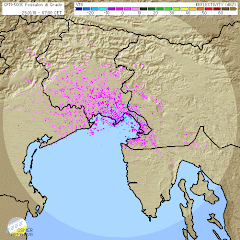
Prilagam nekaj slik ,ki pa so
sicer zelo slabe.Kljub pozni uri sem se odločil da poslikam.Grmet je
začelo ob okoli 00:30 pa tja do 2:30,deževalo je občasno do približno 6
ure.Pri nas je parkrat zagrmelo,središče dogajanja je bilo v
Podlehniku,Žetalah,Krapini,Varaždinu...
Ker je bilo že pozno se mi ni
dalo it na boljšo lokacijo tako sem slikal iz domačega balkona. Strele
so bile preveč oddaljene za boljšo fotko pa tudi sam se še lovim z
nastavitvami. Do jutra je pri nas padlo 6mm dežja.




Ni komentarjev:
Objavite komentar