VP Orešje pri Ptuju 233 m

VP Orešje pri Ptuju 233 m
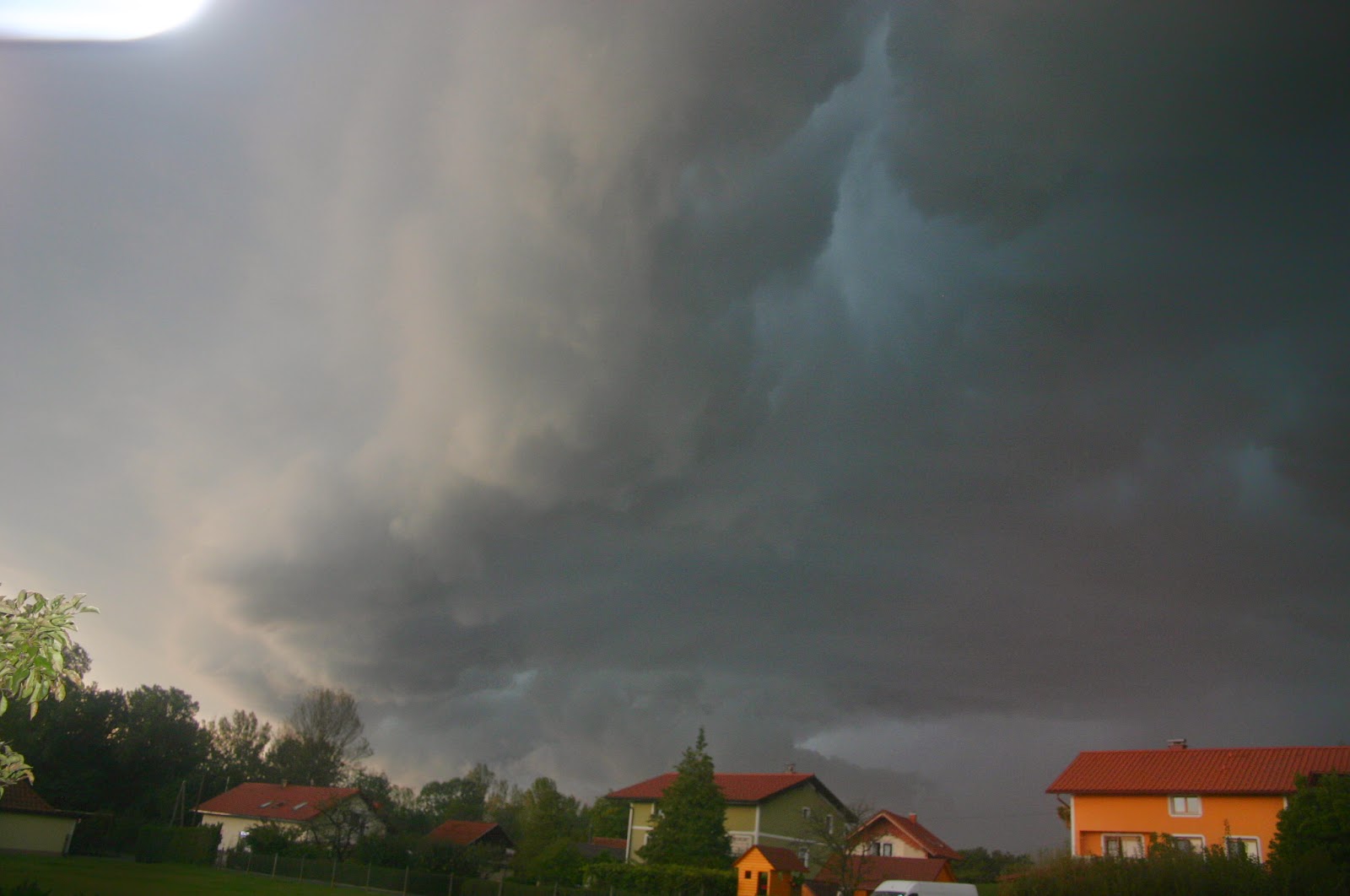
HP supercelična nevihta nad Ptujskim jezerom 13.7.2024
Prikaz objav z oznako Neurja in nevihte v letu 2012(foto arhivi). Pokaži vse objave

torek, 16. oktober 2012

Mimohod nevihte 15.10.2012


Forecast Update
Valid: Mon 15 Oct 2012 16:00 to Tue 16 Oct 2012 06:00 UTC
Issued: Mon 15 Oct 2012 16:03
Forecaster: TUSCHY
A level 3 was issued for Sicily, Malta and far S-Italy mainly for excessive rainfall amounts, very large hail, damaging wind gusts and tornadoes (a signifcant event is possible).

A level 2 was issued for NE Tunisia, the Tyrrhenian Sea, parts of S/C Italy, parts of the Ionian and Adriatic Sea mainly for excessive rainfall amounts, large hail, strong to severe wind gusts and tornadoes.

A level 1 surrounds the level 2 mainly for similar hazards with less coverage and intensity.

SYNOPSIS

Please refer to the main outlook issued at Sun 14 Oct 2012 23:33 Z.

DISCUSSION

... Level 3 and the Tyrrhenian Sea ...

Final storm mode was dictated by mesoscale features until now as seen with back-building and long-lived thunderstorm activity over the C-Tyrrhenian Sea, where a pronounced quasi-stationary outflow boundary caused persistent CI. Further south in the level 3 area, explosive storm cluster developement occurred between Tunisia and Sicily, but this activity remained more progressive and weakened on its way towards Sicily, as it crossed the consolidating warm front/moisture boundary. However, those clusters can't weaken the ongoing moisture return to the north, which is seen in surface data behind the clusters, showing dewpoints in the lower twenties and southerly to southeasterly winds of 10-15 kt (probably channeled between Tunisia and Sicily). Also, southbound moving outflow boundaries south of Sicily weaken quite rapidly which is also a reason of the strengthening southerly background flow. 12Z Trapani samples the environment quite well (although still displaced from the most unstable air mass) with MLCAPE approaching 2000 J/kg, SRH-1 and -3 of 164 and 230 m^2/s^2 respectively and 0-3/0-6 km bulk shear of 18 and 22 m/s respectively.

As of 15Z, the prefrontal wind shift (ahead of the actual cold front) is still over NE Algeria and Sardinia and is characterized by a rapid increase in DMC from N Tunisia to Sardinia. Further improvement of shear and CAPE is forecast over the level 3 area and there is no striking reason to downgrade this area. In fact, we added Malta into the level 3 as decaying outflow boundaries from the daytime storm clusters might serve as additional foci for CI as the major trough approaches. All kind of severe remains possible with that activity.

No major changes were performed to the rest of the level 2 area. The level 1 was expanded to the NW over N-Italy to reflect the heavy rainfall potential until the cold front approaches.

... N-Adriatic Sea ...

We upgraded all of the N-Adriatic Sea to a level 1 and expanded the 50-% lightning area and the level 2 area far to the north. Latest data indicates a more northerly path of the consolidating LL depression and hence a better influx of moist/unstable air that far to the north. Shear remains supportive for organized DMC, which re-develops repeatedly especially along the coast of the NE Adriatic Sea and NE Italy. Heavy to excessive rain will be the main hazard, but more discrete storms along the coast can produce isolated large hail, strong wind gusts and an isolated tornado/waterspout event.

Confidence in an heavy upslope rainfall event along the S-Alps also increases with a pronounced deformation zone in progress. Run-off may be hampered by a gradually lowering transition zone from rain to snow, but still excessive rain may produce some flash flood concerns.

... NW Spain ...

We downgraded NW Spain due to timing issues of the wave. Latest data indicates a somewhat later arrival with less MUCAPE until 06Z and therefore no level area is needed. Nevertheless, heavy rain starts to affect NW Spain after 03Z.

Pretežno oblačno,zjutraj imeli manjšo ploho ,ob 19:30 se je začelo v smeri Podlehnika bliskat ,tako sem hitro odrevel na bljižno lokacijo da bi poslikal strele. Žal nas je nevihta zgrešila ,padlo je par kapelj.nevihta je bila na območju Dornave,Juršinc...Poslikal sem sam otri slike,ki pa so slabe kvalitete saj je na lečo padlo par kapelj.


ponedeljek, 8. oktober 2012

Neurje 7.10.2012


Storm Forecast
Valid: Sun 07 Oct 2012 06:00 to Mon 08 Oct 2012 06:00 UTC
Issued: Sun 07 Oct 2012 06:34
Forecaster: VAN DER VELDE
A level 1 was issued for parts of Italy, Slovenia, Austria, Hungary, Croatia, Serbia and Romania mainly for a chance of an isolated tornado or large hail.

SYNOPSIS

Lows are present over Scandinavia and the Atlantic, with a high in between over British Isles and western Europe mainland.
A cold front is moving southeastward through the region Austria, Hungary, Romania and western Balkan. It is backed by a strong PV intrusion. Iberian peninsula and later western France are in a warm sector. Most CAPE is found across the eastern Mediterranean around Cyprus. Some waterspout type tornadoes may occur there under slow-moving storms.

DISCUSSION

...NW Balkan area...

Some 20 m/s DLS is present and may induce rotating updrafts. LCLs are below 1 km and 0-1 km shear can locally reach 10-15 m/s, mostly predicted to increase as the BL stabilizes during the evening. An isolated tornado or large hail event is not ruled out.if storms manage to grow in the low CAPE, strongly forced environment. The occlusion over eastern Hungary/northwestern Romania may be a focus for this. Over Hungary the frontal passage can be quite gusty. 

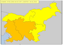
 OPOZORILO METEOALARM
 
velja od 07.10.2012 15:00 CET Do 07.10.2012 23:00 CET
Nevihte  Stopnja ogroženosti: Rumena 
en: Slovenia / North-East : en: Thunderstorms are possible, accompanied by local intense precipitation and gusty winds. sl: Slovenija / severovzhod : sl: Možne so krajevne nevihte z lokalnimi nalivi in močnejšimi sunki vetra. 

 
velja od 07.10.2012 17:00 CET Do 07.10.2012 23:00 CET
Veter  Stopnja ogroženosti: Rumena 
en: Slovenia / North-East : en: maximum wind speed : from 50 to 70 km/h. en: sl: Slovenija / severovzhod : sl: maksimalna hitrost vetra : od 50 do 70 km/h. sl: 

OPIS

 Prav neverjetno je da nas je najmočnejša in najbolj fotogenična nevihta zajela 7 oktobra Shocked Že nevihta 24.9.012 je bila močna,skratka v septembru in oktobru je bilo več akcije pri nas kot v celem poletju icon_wink V bljižni okolici je veter odkril kar nekaj streh in podrl tudi nekaj dreves http://www.24ur.com/novice/slovenija/iz-vlaka-ki-je-trcil-v-deblo-je-izteklo-150-litrov-goriva.html

Čez dan je pihal zmeren do močan jugozahodni veter s sunki do 40km/h. Bilo je delno do zmerno oblačno,maksimalna temperatura je bila 23,3.C ob 15:45.Ob 17 se je iz zahoda oblačnost hitro povečevala. Ob okoli 17:45 ,je začel pihat viharni severozahodni veter ter deževat,najmočnejši sunek je bil kar 51,5km/h ob 17:56,kar je izenačen rekord od kar imam Davisko.Ker je postaja bolj v zaveterju so bili sunki veliko večji. Na Arso postaji Ptuj je bil najmočnejši sunek kar 71km/h,L.Maribor 83km/h ,je pa lokalno veter dosegel 90km/h.Nevihta je ponehala ob okrog 19 ure,padlo je 8,6mm dežja,inteziteta pa je bila 73,8mm/hr ob 18:01,temperatura pa je padla na okoli 13 stopinj.
Na amterski vremenski postaji Mestni vrh pri Ptuju 320m pa je padlo 11,3mm.


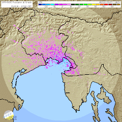
Animacija udarov strel


Animacija padavin


max inteziteta padavin


 Radarski odboji padavin


Še eno ubogo strelo sem ujel,in brez stojala in z neprestanim pritiskanjem na sprožilec


torek, 2. oktober 2012

Nevihta 2.10.2012

Storm Forecast
Valid: Mon 01 Oct 2012 06:00 to Tue 02 Oct 2012 06:00 UTC
Issued: Sun 30 Sep 2012 22:07
Forecaster: TUSCHY
A level 1 was issued for the C-Mediterranean mainly due to large hail (an isolated very large hail event is possible over Sicily/S-Italy), heavy rain, strong to isolated severe wind gusts and a low-end tornado risk.

A level 1 was issued for Slovenia, Croatia and Hungary mainly due to isolated large hail, heavy rain and strong wind gusts.

SYNOPSIS

A constantly weakening upper level trough over Italy continues to move to the E/NE with further weakening anticipated. Scattered to widespread convection occurs in the area of influence of that trough and thunderstorm activity may spread far to the NE. A weak cold-core low affects the far E-Mediterranean/W-Turkey but the highest probabilities for isolated deep convection evolves to the east of our forecast area. Weak ridging affects parts of NE Europe, before another trough approaches NW Europe from the Atlantic.

DISCUSSION

... C-Mediterranean, parts of the Balkan States all the way to W-Ukraine ...

Constantly de-amplifying upper trough slowly moves to the ENE and finally atop the Adriatic Sea during the overnight hours. This feature will be the main reason for scattered to widespread CI within the highlighted areas. Despite the favorable conditions for CI, it remains uncertain, where any hot spot of thunderstorm activity might be as mid level trough looses organization and surface boundary outruns best forcing and slowly dissolves over S-Italy and the Ionian Sea.

Brisk SW-erly flow with moderate shear values of 15-20 m/s overlap with moderate to strong CAPE signals on the order of 1-1.5 kJ/kg MLCAPE (peaks mainly offshore and along the coastal areas with lower values onshore). Therefore, conditions remain supportive for organized multicell thunderstorms and isolated supercells. Large hail, strong to isolated severe wind gusts and heavy rain will be the main risk next to a low-end tornado risk with any mature supercell. However, there is the chance of a more robust severe risk for the following areas:

a) Sicily and S-Italy see rich BL moisture with surface dewpoints in the lower to mid twenties and steep mid-level lapse rates atop, which will yield MLCAPE in excess of 2000 J/kg. Despite some forcing affecting the area of interest during the day, models hesistate to show any more robust CI as strong cap weakens only on a slow rate from NW to SE. Any storm, which manages to evolve will be able to produce large hail (an isolated very large hail possible), strong to severe wind gusts and heavy rain. A sporadic tornado event depends on mesoscale features like outflow boundaries or locally enhanced shear by the orography.

b) C-Italy and E/NE coast of the Adriatic Sea. Placed beneath an unidirectional sheared environment with a favorable connection to rich moisture may result in a few training thunderstorm events. Despite weak flow in the lowest 2 km for most places, local models indicate the chance of a few convergence zones, which might be the foci for training or slow moving CI. Heavy rain will be the main hazard with that activity.

Uncertainties remain too high to upgrade any part of the broad level 1 area.

During the afternoon hours onwards, a plume of deep tropospheric moisture advects NE-wards along the W fringe of a NE-ward fanning EML. With large scale forcing approaching from the SW, thunderstorms may spread far to the NE. During the afternoon and evening hours, surface based convection will be possible especially over Croatia and Hungary. Isolated large hail, heavy rain and strong wind gusts will be the hazard. Betimes, storms become more elevated and sub-severe, while affecting parts of the W-Ukraine and S-Belarus during the night.


Prilagam nekaj slik ,ki pa so sicer zelo slabe.Kljub pozni uri sem se odločil da poslikam.Grmet je začelo ob okoli 00:30 pa tja do 2:30,deževalo je občasno do približno 6 ure.Pri nas je parkrat zagrmelo,središče dogajanja je bilo v Podlehniku,Žetalah,Krapini,Varaždinu...
Ker je bilo že pozno se mi ni dalo it na boljšo lokacijo tako sem slikal iz domačega balkona. Strele so bile preveč oddaljene za boljšo fotko pa tudi sam se še lovim z nastavitvami. Do jutra je pri nas padlo 6mm dežja.


Animacija padavin


torek, 25. september 2012

Nevihta 24.9.2012


Storm Forecast
Valid: Mon 24 Sep 2012 06:00 to Tue 25 Sep 2012 06:00 UTC
Issued: Sun 23 Sep 2012 22:13
Forecaster: TUSCHY
A level 2 was issued for S/SE France and N-Italy mainly for excessive rainfall, large to very large hail, severe wind gusts and an isolated tornado event.

A level 1 was issued for parts of Benelux and Germany mainly for strong to severe wind gusts and an isolated tornado event.

A level 1 was issued for far SE Germany and parts of N-Austria mainly for large hail and strong to severe wind gusts.

A level 1 was issued for parts of the E-Adriatic Sea mainly for large hail, heavy rain, strong to severe wind gusts and an isolated tornado risk.

SYNOPSIS

The predominant vortex over N-Europe shifts eastward, stepping aside for another cyclonic vortex, which approaches from the N-Atlantic. A strengthening depression from the Bay of Biscay gets incorporated into the circulation of the second vortex and the net result will be a major cyclonic vortex, centered over UK, which becomes the steering mechanism for quite some time. Over the Mediterranean, geopotential heights start to decrease with weak ridging present over the far E-Mediterranean.

Side-note:
Multiple structural changes occurred and will occur with the consolidating depression, which moves off the Bay of Biscay to the north/northeast. After initiated by a southbound moving upper low with a distinct tropopause fold during the overnight hours of the 21st to the 22nd, roughly 36h of a slightly less barocline atmosphere allowed for some low-end core modification, although negligible (and still classified as a true cold core low). As of writing (23rd), a plume of slightly modified tropical air (modified due to onshore trajectories into the depression's center), encircled most of the center and assisted in disorganized but slightly deeper convection with no distinct banding present. However this pushed the depression near the shallow warm core structure on available phase diagrams. During the afternoon hours of the 23rd however, an approaching frontal boundary from the NW marked the beginning of another round of enhanced baroclinity with models showing the evolution of a distinct tropopause fold over Ireland and UK during the forecast period, bending into the system. This increase of baroclinity results in a rapid deepening phase, which starts around the beginning of my forecast period and offers a central pressure drop of at least 10 K in probably less than 24 h while crossing UK from the SW with a strong turn to the NW during the night.

This results in a quite complex frontal and thermal structure of that low, as the majority of the models now propose some type of thermodynamic core modification. Current thinking is that a moderate warm-core seclusion takes place during the forecast although described history of that depression may offer a better defined LL warm core structure compared to truley extratropical cases. Latest ASCAT scans reveal a quite symmetric near surface wind field with uncontaminated 30-40 kt winds along the W/S and SE-ern fringes (much less defined along the NE quadrant) and this well defined wind field in the lower troposphere remains intact during much of the forecast period.

To complicate that scenario once more, ongoing baroclinic transformation will result in more typical vertical wind field distribution of the extra tropics along the southern fringe, as a strong mid/high-level jet moves in from the west and crosses N-France and Benelux during the night. Along the northern fringe of the depression however (e.g. N-UK and Scotland), no modification is expected until 06Z due to the dominant and still westward pointing wrap-around occlusion, which keeps the shallow warm core intact.


DISCUSSION

... Far E-France, parts of Germany and parts of Benelux ...

At 06Z, a strongly tilted warm front will be situated over the Netherlands and N-Germany with a slow down of its northward shift forecast (in response to the rapidly deepening low over the UK). A surface cold front is about to exit E-France with a rapid NE-ward motion, so a constantly narrowing warm sector over Germany will be the result with some type of triple point evolving over NW Germany during the night, as the occlusion process builds east.

At mid/upper levels, a NE ward swinging trough affects the area of interest. This trough weakens significantly during its shift to the NE with strong mid-level NVA forecast atop the NE-ward surging cold front. Strong frontal circulation of the cold front however may offset some of those more negative effects in addition to other models, showing the upper trough slightly stonger with better cyclonic curvature. CI should occur, given weakly capped warm sector and healthy looking cold front. Scattered DMC activity is forecast.

From the thermodynamic perspective, the (sub)tropical background of that air mass features weak mid-level lapse rates for all areas beside those along and just north of the Alps (where Alpine EML fans out to the NE, affecting SE Germany and parts of Austria during the forecast). Forecast soundings confirm MIMIC-TPW output with 30 to roughly 40 mm TPW present behind the warm front, as deep plume of moisture spreads NE-wards. Of concern is the cloudy warm sector, which keeps diabatic heating limited, although not much extra heating is needed for some CAPE build-up, given surface and 925 hPa dewpoints in the mid tens (with a few stations upstream (NE France) even reporting surface dewpoints in the upper tens). Models like WRF show some break up of the thick cloud shield, so even some diabatic heating is forecast and therefore, we agree in the quite robust CAPE forecast of 500 to locally 800 J/kg MLCAPE (EZ on the lower-end side). CAPE might be the most robust over far NW Germany and Benelux with a second maximum over far SW/SE Germany and N-Austria. In-between (e.g. W-C Germany), somewhat worse moisture/stronger BL mixing result in substantially lower CAPE. Finally, LL CAPE might be enhanced as seen in some forecast soundings.

Kinematics are good, especially at lower levels. With the eastward punching mid-high level jet from N-France probably arriving too late, DLS remains modest with 15 to locally 20 m/s, nevertheless enough for organized convection. Similar shear magnitude however is also forecast in the lower troposphere (3km and 1km bulk shear). Not only the speed shear, but also SRH is enhanced with peaks in excess of 200 m^2/s^2 in the lowest km (e.g. ahead/along of the cold front).

Numerous rounds of CI are forecast:

a) Sporadic warm front activity over NW-Germany (ongoing from the overnight hours). Forecast soundings show some MUCAPE with veered profiles, but nothing severe is forecast. This was the main reason for expanding the low prob. lightning area far to the NE over NE Germany. The risk wanes until noon.

b) Warm sector convection. Coverage of convection is uncertain and depends on isolated better diabatic heating and forcing. Current thinking is that the Netherlands/NW Germany may see isolated activity during the morning hours onwards. However it will take some time before thunderstorms become surface based (probably until noon), so again no severe risk is forecast with that activity (at least until noon).

c) The main risk seems to evolve along the cold front and potential prefrontal convergence zone, which crosses the highlighted area during the daytime hours from SW to NE. Generally, the Netherlands/NW Germany (arrivial during peak heating) and SW Germany (better BL moisture) may see the highest probabilities for thunderstorms with less activity in-between. With worsening background forcing, a broken line of showers and thunderstorms is forecast, probably more solid over NW-Germany. Severe wind gusts will be the primary risk (with 25 m/s in 850 hPa) , but would not be surprised to see an isolated tornado report. The overall tornado risk might be steered by mesoscale processes/boundaries and locally better heating and therefore the overall risk is hard to pinpoint that far out. Over W-C Germany the severe risk might be low due to weak CAPE, but model forecasts diverge too much to split the level 1 into two distinct areas. Also, not much downward transport needed to mix 20-25 m/s winds down to the surface in showers/thunderstorms. The severe risk rapidly diminishes after sunset.


... SE Germany and N-Austria ...

The set-up seems quite favorable for an organized prefrontal wind shift zone, which races eastwards during the late afternoon and evening hours, affecting SE Germany and N-Austria. Given steeper lapse rates aloft and improving BL moisture result in roughly 800 J/kg MLCAPE. The consolidating convergence zone over S-Germany may spark isolated thunderstorms, also moving off the N-Alps to the NE. Northward expanding cirrus shield of an Italian cluster may keep instability limited over the area, which was excluded from the level 1. A few well organized multicells/isolated supercells with strong to severe wind gusts, large hail and heavy rain evolve further east over far SE Germany. Betimes, storms line up while entering N-Austria and the W-Czech Republic with a temporarily enhanced more concentrated severe wind gust risk over N Austria. Rapidly diminishing CAPE should lower the severe risk over the Czech Republic. The highest severe risk probably exists south and east of Munich (Germany) and west of Linz (Austria).

... SE France, parts of Switzerland, N-Italy and far S-Austria ...

An active severe weather day is in store for the area of interest. Falling pressure south of the Alps slows the eastward moving cold front down, while entering NW-Italy. This front may stall for some time, before moving leisurely to the east during the rest of the forecast. A vorticity lobe at mid-levels crosses the area from west to east and moves in an unstable and strongly sheared air mass south of the Alps. 500-1000 J/kg MLCAPE, 20-25 m/s DLS and 15 m/s 0-3 km shear create a favorable set-up for well organized multicells/supercells.

Current thinking is that an ongoing cluster of showers/thunderstorms approaches from S France (probably featuring a V-shaped MCS), which enters NW Italy until noon. The main risk with that activity will be excessive rain due to slow moving storms and abundant influx of moist Mediterranean air from the south. The tail-end of the MCS (e.g. along the coast of S/SE France) may be accompanied by isolated supercells with large hail and an isolated tornado risk, which was the reason for upgrading that part.

Thereafter, storms rapidly spread or evolve east over N Italy with well organized multicells/isolated supercells forecast. All kind of severe is forecast with strongest storms, including large to very large hail, strong to severe wind gusts, excessive rainfall amounts and an isolated tornado risk. The rainfall risk may be maximized over far NE Italy/far W-Slovenia.

Thunderstorms continue well into the night while spreading SE-wards along the E-coast of the Adriatic Sea. We also added a broad low prob. lightning area over parts of the N-Balkan States, as plume of better MUCAPE advects east.

... N-UK and Scotland ...

Westward wrapping occlusion shifts only slowly to the north during the forecast period. Prolonged period of lift/forcing/influx of very moist air and slow storm motion indicate a high probability for heavy rain. Some MUCAPE is forecast, so we do not want to exclude a sporadic thunderstorm event (not reflected on our outlook map).
Beside the rain risk, a gradually intensifying easterly LLJ with 850 hPa winds up to 30 m/s results in severe wind gusts over Scotland (especially at more exposed areas). This risk is not included due to non-existent DMC activity.

During the overnight hours, thunderstorm probabilities increase over the English Channel,the S-North Sea and the N-Bay of Biscay as cold air at mid-levels spreads to the south and east.

 Opozorilo (meteoalarm)
 
velja od 24.09.2012 01:00 CET Do 24.09.2012 23:59 CET
Veter  Stopnja ogroženosti: Rumena 
en: Slovenia / North-East : en: maximum wind speed : from 50 to 70 km/h. en: sl: Slovenija / severovzhod : sl: maksimalna hitrost vetra : od 50 do 70 km/h. sl: 

 
velja od 24.09.2012 16:00 CET Do 24.09.2012 23:00 CET
Nevihte  Stopnja ogroženosti: Rumena 
en: Slovenia / North-East : en: Thunderstorms are possible, accompanied by local intense precipitation and gusty winds. sl: Slovenija / severovzhod : sl: Možne so krajevne nevihte z lokalnimi nalivi in močnejšimi sunki vetra. 


Opis situacije

Zvečer so se iz jugozahoda približevala nevihtna linija. Zato sem se odpravil na prvi nočni čejs.Sprva sem mislil nevihtno linijo počakat pri Termah Ptuj,vendar sem si zadnji čas premislil in sem se zapeljal na majhen hribček(panorama)Vičava,ki leži zraven bivše vojašnice.Razgled na prihod nevihte je bil odličen .Ob okoli 21:15 se je začelo bliskat v smeri Celja,nevihtna linija je hitro potovala.Tako je ob okoli 21:30 že začelo kapljat,glavnina nas je zajela ob 21:42.Odboji nevihte so bile med 45-50dbz. Ker je bil prehod hiter nisem mogel narest več posnetkov,zato sem še doma iz balkona nekaj poslikal.V nevihti je padlo 4,8mm dežja ,max. inteziteta je bila 55,6mm/hr ob 22:12.Veter je dosegal na vremenski postaji okoli 35km/h ,na bližni Arso postaji,ki je bolj na odprtem pa kar 69km/h.Nevihta je ponehala ob okoli 23:15. Med 00:00-1:30 še malo deževalo padlo je še dodatnih 2,0mm dežja ,skupaj tako torej 6,8mm.


Animacija padavin


 Moja prva CG-jevka buttrock


Slike posnete doma iz balkona


sobota, 8. september 2012

Nevihta 6.9.2012


Nevihta,6.9.2012
Med okoli 1:30-2:30 nevihta z dokaj močnim nalivom in bliskanjem.Nevihta je prišla iz smeri SV,V(smer Murska Sobota). Bili smo na obrobju nevihte,središče je bilo proti Mariboru.
Po nevihti je še do okoli 5:30 občasno rahlo deževalo. Skupaj je padlo 8,4mm dežja,max inteziteta padavin 51,6mm/hr ob 2:06. Na sosednjih vremenskih postajah je bila količina precej manjša.

Ptuj-Ljudski vrt :3,0mm
Arso Ptuj(Terme):0,9mm
Ptuj-Prelog:0mm

Še nekaj padavinskih podatkov iz amaterskih postaj po Sloveniji.
Vp Novo Mesto(Mačkovc): 75,7mm
Lešnica,Otočec ob Krki:55mm
VP Laško 420n.m.v. :54,4mm
Lobnica pri Pohorju:31,0mm
Družinska vas:22mm


Prva ujeta strela.(Canon 300D) 


ponedeljek, 30. julij 2012

Nevihta doma in čejs po Dravskem polju 29.7.2012


Storm Forecast
Valid: Sun 29 Jul 2012 10:00 to Mon 30 Jul 2012 06:00 UTC
Issued: Sun 29 Jul 2012 12:05
Forecaster: VAN DER VELDE
A level 1 and 2 were issued for Italy, Austria, Slovenia, Croatia, Hungary, Slovakia, eastern Poland, Batltic states mainly for severe wind gusts and large hail.

A level 1 was issued for eastern Germany, northern Austria, Czech republic, western Slovakia, western and northern Poland mainly for isolated excessive convective rain.

A level 1 was issued for eastern Finland and NW Russia mainly for severe wind gusts, tornado chances and large hail.

A level 1 was issued for NE Spain mainly for large hail.

SYNOPSIS

A very large scale 500 hPa low centered over Scotland spans across most of Europe with a cyclonic flow pattern. Western Russia and eastern Belarus and Ukraine are under the influence of an anticyclone. At mean sea level, high pressure is only present deep into Russia and over the Atlantic near the Azores with a ridge toward France. Moderate unstable airmass stretches from northern Ital, Hungary, eastern Poland, Baltics all the way info northern Finland. A wave along the western side of the airmass moves from N Poland over the Baltic Sea northward.

DISCUSSION

...N Italy, Austria, Hungary, Slovakia, Poland...

09Z observations indicate 13-16 g/kg mixing ratios across Poland and Hungary. The area appears divided into a humid, cloudy western section with less than 500 J/kg but high precipitable water content and a dry eastern section where MLCAPE values will easily reach 1200-2500 J/kg over a large region. Both areas are under moderate 10-15 m/s 0-6 km shear which can organize multicells and supercells, the latter especially when helped by local orographic winds. These will produce large to very large hail. 00Z Poprad sounding shows around 11 g/kg mean 0-1000m mixing ratio under a very dry 25 degrees dewpoint spread in mid levels. This evaporative cooling potential is very favorable for microburst and general gust threat. N Italy will see fewer storms, as the trough passes early. It has a better timing for Hungary northward.

...N Poland and Baltic states...

The interface between the moist and dry regimes can see locally excessive convective rainfall, in particular near the occlusion tracking from N Poland northward near the coast of Lithuania and Latvia, mostly remaining over sea. This region is more interesting however because of the presence of large 0-1 km shear (15 m/s) and 0-6 km shear (20-25 m/s) which enhances potential for tornadogenesis and also favors bow echos producing severe wind gusts in the high LCL, high delta-theta-e airmass across the Baltics. Large hail is also likely. The cold front extending southeastward from the occlusion will have a more favorable angle with the flow to produce a severe wind producing squall line over NE Poland into Lithuania and Latvia.

...Finland and NW Russia..

While deep layer shear is just 10-15 m/s, 0-1 km shear and 0-3 km SREH are enhanced to 10 m/s and 200 m2/s2 respectively, which in combination with 400-800 J/kg MLCAPE creates favorable conditions for some storms with rotating updrafts producing hail and severe wind gusts. A tornado is not excluded as well. Background flow in lowest kilometers is around 30 kts.

... SE UK...

The low-level instability under the upper low over British Isles and Benelux may give rise to some spout-type tornadoes, if winds would weaken.

...NE Spain...

Large hail could occur in isolated supercell storms forming in a moderate shear environment (20 m/s) with high cloud base.

Opozorilo od ARSA je bilo izdano naknadno

velja od 29.07.2012 13:00 CET Do 29.07.2012 23:00 CET
Nevihte Stopnja ogroženosti: Oranžna
en: Slovenia / North-East : en: Heavy thunderstorms are possible, accompanied by local intense precipitation, hail and gusty winds. sl: Slovenija / severovzhod : sl: Možne so močnejše krajevne nevihte z nalivi. točo in močnejšimi sunki vetra.


Napoved velikosti toče.


Lifted index je bil kar 10


Cape(Energija) je bil zelo visok na vzhodu države med 3000-3500J/kg)


Še pogled na spletno kamero. Vidni že prvi nevihtni oblaki v smeri Avstrijske Koroške.


Ob 15:45 sem se odločil da grem na čejs na Dravsko polje. Nevihtna linija je prihajala iz Avstrijske Koroške. Najboljšo pozicijo sem imel na območju Rač ,kjer sem imel razgled na dve celici,eno v smeri Radelj ob Dravi drugo pa na območju Šentilja oz Pesnice..Po vsej verjetnosti sta bili supercelici.Kakšnih zanimivih struktur pa žal ponovno ni bilo.Bilo je zelo vetrovno max sunek je bil 60km/h 16,7m/s,lokalno tudi več izmerjen pa na območju Rač,Kungote...


okolica Rač


Nevihtni oblak,slikano na Hajdini pri Ptuju.


 Nekaj polomljenih vej v Hajdošah(blizu term)


Nevihta doma
Nevihta med 18:18:40 doma.Padlo je 8,6mm dežja, max inteziteta padavin je bila 126,6mm/hr.Med okoli 18:09-18:15 je tudi padala toča max premer 1cm. Pred nevihto ob 16:49 je zapihal močan SZ veter,ki je dosegel drugo najvišjo hitrost vetra od kar imam Davisko,in sicer 48,3km/h ,na odprtem tudi do 60km/h(ponekod na Dravskem polju tudi do 70km/h). Maksimalna temperatura je bila 31,0 stopinj C.Bilo je zelo soparno vreme ,saj vlaga ni padla pod 50%. Najnižja je bila ob 16:48 in sicer 51%, rosišče pa je bilo 22 stopinj C.


Močan veter max sunek 60km/h 16,7m/s
http://www.youtube.com/watch?v=CVPEdLsfF60&feature=plcp

http://www.youtube.com/watch?v=OC9yeakScIc&feature=youtu.be

Supercelica?
http://www.youtube.com/watch?v=0QyOjv2tB8M&feature=youtu.be

Naj 5 dogotkov v letu 2012

Naj 5 vremenskih dogodkov v letu 2012


1. Huda vročina in suša v drugi polovici avgusta(15-25.8.2012)
Avgusta sta nas zajela dva močna vročinska vala. Prvi je trajal od 1 do 6 avgusta,najvišja temperatura je bila dne 5 avgusta in sicer 34,7 stopinj C.
Med 15 in 25 avgustom,nas je zajel izjemno hud vročinski val. Ponekod v jugovzhodni Sloveniji so bile temperature tudi do 39 stopinj C. Na vremenski postaji Orešje pri Ptuju je bila zabeležena najvišja avgustovska temperatura in sicer 36,6 stopinj C dne 22.8.2012. Povprečna mesečna temperatura v avgustu je bila 22,0 stopinj C,kar je nov rekord. Med 1-26 avgustom je bila povprečna temperatura celo 22,5 stopinj C. Vročinski val je trajal kar 11 dni,v tem obdobju je padlo le 1,2mm dežja(23.8). V celem avgustu pa samo 24 mm dežja. Zaradi hude suše je začelo odpadat listje z dreves. Po 26 avgustu je vročina popustila.

Slike suše

Tabela max. temperatur med 15-25 avgustom.

Datum
Tmax.
Čas izmerjene temperature
15.8.2012
30,5 °C
17:10
16.8.2012
30,6 °C
16:18
17.8.2012
30,7 °C
18:25
18.8.2012
30,5 °C
16:30
19.8.2012
32,4 °C
17:19
20.8.2012
35,1 °C
16:28
21.8.2012
35,6 °C
17:19
22.8.2012
36,6 °C
17:05
23.8.2012
32,9 °C
18:15
24.8.2012
36,4 °C
16:43
25.8.2012
34,8 °C
17:30

2. Viharni jugozahodni veter 25.12.2012
Izjemno vetroven Božični dan. Sunki jugozahodnega vetra so po nižinah dosegali do 80km/h ,v nekoliko višjih legah pa do 100km/h. Tako doma kot na sosednjem hribu(Sovretova pot 300m) je bil zabeležen nov rekord. Na VP Orešje pri Ptuju je bil največji sunek izmerjen ob 10:09 in sicer 61,2km/h(sunki so bili tudi do 75km/h,zaradi sunkovitega vetra se je konstrukcija vremenske postaje ob večjih sunkih zamajala,zato so bili dejanski sunki nekoliko večji). Povprečna dnevna hitrost vetra je bila 16,3km/h. Med 10:30-11:10 sem z ročnim merilcem(Windmaster 2) meril na bližnjem hribu,kjer je izrazito izpostavljena lega za JZ veter. Izmeril sem rekorden sunek vetra in sicer 90km/h(25m/s) ob 11:02. Omenjen sunek spada po 12 stopenski Beaufortovi lestvici pod močan vihar(10 stopnja). Sunki so bili med 12-14 uro lahko blizu 100km/h.


Slikovna napoved(Vir.Arso)


Podrto drevo ,Orešje-Sovretova pot pri Ptuju.Vir:24ur.com


Modelska napoved največjih sunkov vetra(Aladin)

Veter je povzročil ,kar nekaj škode(Vir Rs za zaščito)

Beaufortova lestvica: 10

m/s 24.5 - 28.4
km/h 88 - 102
vozli 48 - 55
povprečna hitrost vetra v vozlih/km/h/mph: 52 / 96 / 60
opis vetra: močan vihar (tempesta, unwetter, storm)
učinek na kopnem: dviga strehe in podira drevesa
učinek na morju: gladina "zamegljena" (very high waves, the sea surface is white and there is considerable tumbling, visibility is reduced)
višina valov: 9 (~ 29,5 ft)
Mediji
Intervencije
http://www.sos112.si/db/priloga/p15779.pdf
Analiza vremena 23-26 december(Arso)
http://meteo.arso.gov.si/uploads/probase/www/climate/text/sl/weather_events/visoka-temp-veter_23-26dec12.pdf

Video močnega vetra Orešje pri Ptuju(Matej Štegar)


3. Sneženje ter hud mraz od 2 do 14.2.2012

Sneženje 4.2.2012
Dopoldan začel naletavat sneg,ki se je okrog 11 ure okrepilo v rahlo do zmerno sneženje.
Sneženje je ob okoli 21:00 ure ponehalo. Zapadlo je 3,5cm suhega snega. Količina padavin je bila 0,8mm. Občutek mraza je bil najvišji ob 18:04 in sicer -13,3.C.
Sneženje 6-7.2.2012
Ob okoli 7:30(6.2.012) je začelo rahlo snežit,ki se je dopoldan nekoliko okrepilo v zmerno sneženje. Popoldan je za krajši čas ponehalo ,vendar se je proti večeru ponovno okrepilo.
Do 20:30 padlo 6,5cm novega ,skupna višina je znašala 8,5cm. Količina padavin je bila 2,6mm.
Sneženje se je nadaljevalo v noč na torek,in v torek popoldan ponehalo. Skupaj z (6.2.012) je padlo 17cm suhega snega. Količina padavin je 7.2.2012 bila 6,6mm.
Tudi maksimalna dnevna temperatura je bila zelo nizka ,in sicer v ponedeljek(6.2) je bil dnevni maksimum le -7,9°C . V torek (7.2) pa -7,3°C .

Hud mraz 8 in 9.2.2012 ,in zaledenela reka Drava 8.2.2012
Nad nami je prevladoval hladen sibirski zrak.
V torek 7.2.2012 se je zvečer ob okoli 21:00 razjasnilo. Temperatura je zaradi jasnega in mirnega ozračja ter snežne odeje(suh sneg) začela hitro padat. Do polnoči je padla na -11,7°C (ob 23:33). V sredo zjutraj 8.2.2012 ,je bila najnižja temperatura -17,2°C (ob 6:32),na 5cm nad snežno odejo je bila temperatura -22,4°C .

Tudi v sredo zvečer(8.2.202) je temperatura izjemno hitro padala.
Pad temperature po urah.
Ob 20:00, -12,7°C
Ob 21:00, -13,8°C
Ob 22:00, -14,6°C
Ob 23:00 , -15,4°C
Četrtkovo jutro(9.2.2012) je bilo izjemno mrzlo,najnižja jutranja temperatura je bila -18,4°C ob 2:58. Če se ne bi proti jutru pooblačilo bi bil z lahkoto dosežen nov rekord. Temperatura 5cm nad snežno odejo je bila kar -23,9°C. Temperatura na Dravskem in Ptujskem polju se je mestoma spustila do okoli -21,0°C .
Še minimalne temperature v obdobju med 2 in 14 februarjem
Datum
Tmin.
Čas izmerjene temperature
2.2.2012
-9,7°C
7:45
3.2.2012
-10,9°C
7:15
4.2.2012
-9,2°C
20:45
5.2.2012
-10,4°C
7:06
6.2.2012
-10,4°C
3:15
7.2.2012
-11,7°C
23:33
8.2.2012
-17,2°C
6:32
9.2.2012
-18,4°C
2:58
10.2.2012
-11,2°C
5:31
11.2.2012
-10,0°C
4:00
12.2.2012
-8,6°C
0:15
13.2.2012
-9,2°C
7:15
14.2.2012
-13,9°C
6:16

Več na blogu

4. Katastrofalne poplave reke Drave 5-6.11.2012
Reka Drava je začela naraščat zgodaj zjutraj(5.11) med 10-11 uro se je začela razlivat na območju vsakoletnih poplav. Ker so se čez noč karte spremenile je bilo največ padavin na Gorenjskem ter Koroškem ter tudi na avstrijski strani. Tudi meja sneženja je bila zelo visoko in je dodatno pripomogla k naraščanju Drave. Avstrijske hidroelektrarne so zgodaj zjutraj obvestile Arso,da bodo ob okoli 12 ure spustile ogromno količino vode tam okoli 2000m/s3. Zato je bilo za zgornjo in spodnjo Dravo razglašen rdeč alarm pred silovitimi poplavami. Največji pretok reke Drave je bil do zdaj leta 1965 2600m/s3 . Tokratni pretok je bil na Ptuju ocenjen med 3100-3200m/s3. Najvišji vodostaj je bil med 19uro zvečer(5.11)in 1uro zjutraj.
V Orešju pa so pri reševanju pomagalo tudi okoli 20 vojakov in nekaj gasilcev.

Nekaj video posnetkov tega izjemnega dogodka.

Naraščanje Drave(med 10-11uro)

Reportaža


5. Sneženje konec oktobra (28-29.10.2012)
Med 2:30-3:30(28.10)je 4x zagrmelo,ob okoli 2:30 je dež prešel v zmerno do močno sneženje. Med okoli 5-6 uro smo bili brez elektrike,ter še nekaj malega čez dan. Veliko vej,dreves je bilo polomljenih.
Ob 8 uri sem izmeril na beli leseni deski ,kar 6,5cm južnega snega ,skupaj je najvišja snežna odeja znašala 7cm. Popoldan je bilo večinoma suho ,ob okoli 15.55 je začel ponovno dež s snegom .Zvečer ter v drugem delu noči(29.10) je rahlo snežilo padlo je dodatnih 4cm,tako je bila najvišja snežna odeja v oktobru od kar merim(2001)9cm ob 8uri(29.10). V tem poslabšanju od 26-29.10.2012 je padlo skupaj 77,2mm padavin. Dne 26.10(3,6mm)27.10(41,8mm)28.10(29,6mm)29.10(2,2mm). Skupna akumulativa zapadlega snega je bila 11cm. Na vremenski postaji Mestni vrh 320m sem v ponedeljek(29.10) ob 10uri izmeril kar 15cm.

Bohinj 5.3.2011(Srečanje ZEVS)

Bohinj 5.3.2011(Srečanje ZEVS)

VP Orešje v štajerskem Tedniku

VP Orešje v štajerskem Tedniku

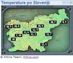
Trenutne temperature po Sloveniji(Amaterske postaje)

Arhiv podatkov(Postaje Zevs)

Statistika vremenskih podatkov(Zevs)

Radar Lisca

Radar Bilogora (Hrvaška)

Radar Osmer

Radar Nemčija

Meteoalarm

Kontakt:

Matej Štegar:Član vremenskega društva ZEVS
e-mail : mstegar@gmail.com
gsm: 040644540
Nov spletni blog numizmatika:http://numizmatika-matej.blogspot.com